Lake Fire nears 27,000 acres; containment at 16 percent
By Michael Chaldu · Sat Jul 06 2024
Evacuation order issued for Woodstock, Goat Rock areas; other warnings in effect
By Mike Chaldu
michael@santaynezvalleystar.com
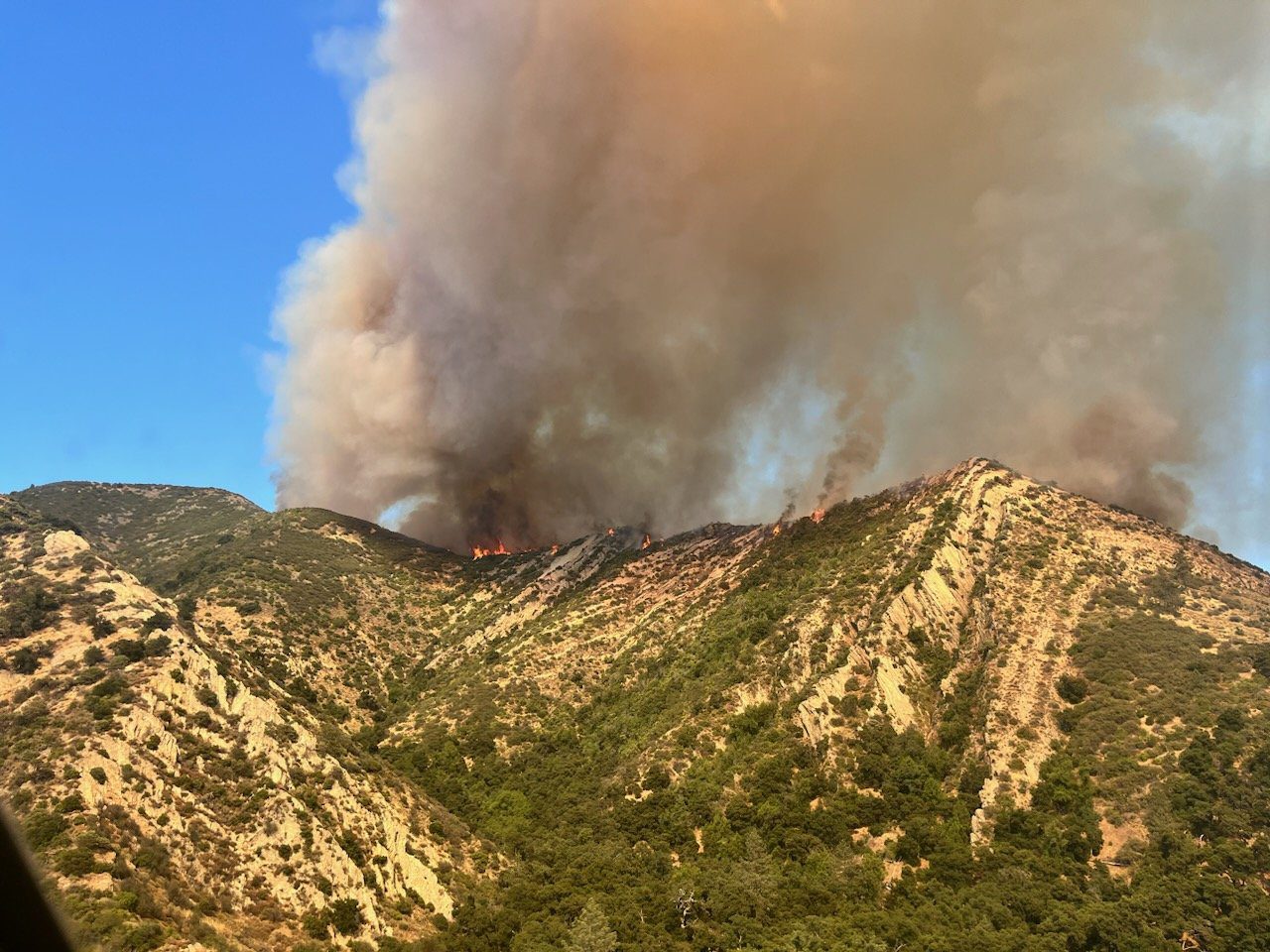
The Lake Fire, which was first reported Friday, July 5, is now grown to 26,986 acres and is at 16 percent containment, according to the latest incident update by Cal Fire (www.fire.ca.gov/incidents/2024/7/5/lake-fire) at 5:57 p.m. Tuesday, July 9.
At 12 p.m. on July 9, the Santa Barbara County Sheriff’s Office issued an Evacuation Orders for the Woodstock and Goat Rock areas the SB Ranger area (remote forest area east of Goat Rock). Anyone occupying the area has been toldto leave the area immediately.
Areas under evacuation orders as of Tuesday evening were:
- Woodstock and Goat Rock Areas
- SB Ranger area (remote forest area east of Goat Rock)
- Parts of the Figueroa Mountain area as follows: south of Tunnel House at Sisquoc River, east of Figueroa Creek, north of the southern end of Cachuma Mountain, and west of Los Padres National Forest areas
- All areas from Figueroa Mountain Road at Junction Camp (including Tunnel Rd) to Chamberlin Ranch and all areas from Zaca Lake Rd at Foxen Canyon Road north to the Sisquoc River including east of Foxen Canyon Road to the 9000 block.
Those area under an Evacuation Warning are:
- Area east and north of Alisos Rd (L-shaped road), west of Cachuma Creek, and south of the US Forest Service entrance at Happy Canyon Road.
- Area east of Highway 154, north of Armour Ranch Road/Secretariate St, west of Alisos Rd, and south of the Woodstock area.
- Area east of Figueroa Mountain Road, north of Highway 154, west of Calzada Ave/W Oak Trail Rd and south of Woodstock Rd.
- Area of Goat Rock, east of Figueroa Creek, north of the US Forest Service entrance at Happy Canyon Road, and south of Cachuma Mountain
- Areas north of Calzada Ave, east of E. Oak Trail Rd., west of Happy Canyon, and south of the Sisquoc River
A shelter has been set up at the Solvang Veterans Memorial Hall at 1745 Mission Drive in Solvang.
The fire is burning on Los Padres National Forest's Santa Lucia Ranger District and adjacent state land. Forest officials reported Sunday that there were approximately 1,000 firefighters assigned to the blaze, along with a full complement of air resources. A cause for the fire has not yet been determined, but the investigation continues.
The firefighting efforts are under the Unified Command with California Complex Incident Management Team 13, led by Incident Commander Joshua Boehm, and including USFS Los Padres National Forest, Santa Barbara County Fire and Cal Fire, according to LPNF officials. Cooperators working on this incident include Santa Barbara County Sheriff'sDepartment, Santa Barbara Office of Emergency Management, Santa Barbara County Department of Public Works, the Chumash Fire Department, the California Highway Patrol, and California Office of Emergency Services.
"Significant fire activity was in the wilderness area on the east side of the fire footprint," the Los Padres National Forest has stated in a Tuesday, July 9, release. "It resulted in significant smoke and expanded evacuation orders for remote areas. The main priority is to prevent the fire from moving toward communities to the south.
LPNF reported a Red Flag Warning has been issued for the fire area with strong winds, potential for longer fire spotting distances along with hot, dry conditions. Damage assessments are ongoing as crews locate any structures impacted by the fire.
The area the fire originated from is approximately 15 miles north of Los Olivos and approximately 20 miles east of Los Alamos. The blaze was also getting closer to the former Neverland Ranch, which was Michael Jackson's residence, and the Midland and SYV Family schools.
More information on the fire and evacuations can be found at www.countyofsb.org/4275/Lake-Fire-Incident---July-5-2024 or by calling the Santa Barbara County Call Center at (833) 688-5551.
The fire was first reported Friday, July 5, at 3:48 p.m., and flames were visible from parts of the Santa Ynez Valley overnight.
Santa Barbara County Public Information Officer Capt. Scott Safechuck reported on July 6 that temperatures in the area were in the high 90s with a relative humidity of 11 percent. According to the Western Fire Chiefs Association website (wfca.com), "when relative humidity decreases, fire behavior increases because fine fuels like grass and pine needles become drier quickly," and "low humidity levels dry out vegetation fuels on a short-term basis, and they can also cause a short-term spike in fire danger." The National Weather Service considers low humidity to be anything equal to or less than 55 percent.
Meanwhile, the Santa Barbara County Public Health Department and the Santa Barbara County Air Pollution Control District issued an Air Quality Watch for Santa Barbara County to be in effect until conditions improve.
"The Lake Fire is producing significant smoke that is aloft in the skies, currently ground level conditions are good to moderate countywide," the agencies' joint press releases says. "This is a dynamic situation, and local air quality conditions can change quickly. All Santa Barbara County residents are encouraged to stay alert to local conditions by visiting www.ourair.org/todays-air-quality or fire.airnow.gov."
The Santa Ynez Valley Star will continue to update this story.